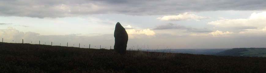


Portfield the unlikely hill fort.
Evidence of long-distance trading is overwhelming from ancient times. Consideration of the economic dimension is essential if we are going to have any understanding of the past. The distribution of polished stone axes from the Langdale axe factories suggests long distance trade in very ancient times, which we might not readily associate with economic activity. The development of metal technology saw tin, copper and gold traded over long distances. The maintenance of life would have required the trading of other commodities, of which salt is the most obvious. The main sources of tin, gold and copper in north-west Europe are located in Cornwall, Ireland and North Wales. These products would have been traded eastwards into the mainland continent. This long distance precious product trade would have been supplemented by more regional trade in more common commodities such as food and slaves.
The landscape of Lancashire can be described as a natural geographical unit bounded by the Irish Sea coast to the west, and the Pennine hills to the east. River valleys run from the hills to the sea. The Mersey/Irwell forms the southern boundary, and the valley of the Lune defines the boundary with the Lake District. If we are looking for an east /west trade route, the only low level pathway across the Pennines would utilise the valleys of the Ribble/Calder in the west, and the Aire/Wharfe in the east. The discovery of Bronze Age sea-going craft in the Humber mud flats suggests a trans-North Sea trade from this estuary. Suggestions for a potential natural harbour on the Lancashire coast are limited by geographical features. In Morecambe Bay traitorous sands would discourage all but the most confident navigator. Sand hills backed by water logged land dominated much of the coast north and south of the Ribble. It is in fact the Ribble which suggests itself as a natural haven.
In Roman and Norman times evidence of economic activity can be cited on the south bank of the Ribble at Walton and Penwortham. The establishment of the administrative centre of the Palatine County north of the Ribble circa 1200, transferred economic activity away from the south side of the river. Though Preston clearly stands astride the western Pennine north/south trade route, the other ancient trade route from Preston was eastwards into the Ribble valley.
The Ribble and Pendle Ridgeway’s
From ancient times the western route from Preston followed the north bank of the Ribble before crossing the river east of Ribchester at Little Town or Hacking Ford. Paths then converged on the Calder ford at Whalley. A more ancient route can be traced from Walton le Dale via Billinge, Wiltshire, and Billington Moor to converge again on the ford at Whalley. This high level route is the Ribble Ridgeway. From the ford at Whalley the route eastwards divided into a low level route via Clitheroe - the Lincoln Road, and a high level route through the Forrest of Pendle the Pendle Ridge Way. Because the structure of the Lancashire landscape is in this context unchanging, there is no reason to think that these trade routes evidenced for over a thousand years, were very much different in say the Iron or Bronze Age. We say this with confidence because the hills do not move.
Portfield Camp
The significance of Portfield Camp is its location. From Walton, the highest tidal point on the Ribble, it is only a day’s journey. Ancient east/west routes converge on the ford at Whalley in the steep valley below Portfield. To the east small enclosures are to be found in Craven and at Colne, again a days journey eastwards. The fact that they are small is significant; they have all very limited defensive value. From Portfield the western prospect over the Calder valley has clear defensive potential. Remains of what must have been a modest rampart are visible on the northern and southern flanks of the enclosure. There is a gradual upward slope directly to the east of the enclosure - this would have compromised defence in this direction. A traveler coming up from the ford in the valley may well have been impressed by the enclosure. However, its defensive potential from a determined enemy was very limited. Castercliffe poses similar problems. The area within the ramparts is so small that a determined attacker could easily neutralise the defenders with sling or arrow shot. Returning to Whalley, other adjacent hills and positions on hills have far greater defensive potential but were not utilised. The significance of Portfield is that the routes through Pendle and into the Calder valley pass the enclosure. The position of the enclosure dominates this junction of the Calder valley with the Ribble valley and the strategic fords at Whalley. The enclosure can not be understood without reference to these factors.
The evidence of archaeology
The discipline of archaeology, one of the many tools available to the historian and anthropologist, tends to confirm the negative when in operation on its own. Therefore though archaeological research shows activity on this site over a long period, there will never be evidence of continuous occupation. The discovery of flint working within the site of the enclosure is probably coincidental, especially when we consider how many such random sites have been identified of late. As one old cynic commented –‘give anybody a grant and a site and they always turn up worked flints at some stage...’
During the laying of a pile line in 1966 a Bronze Age smith’s hoard including two gold items was discovered within the fort. Excavation in the 1960’s and 1980’s revealed two stages of construction about the time of the late Bronze Age/ Early Iron Age. The 1980’s research suggested buildings inside the enclosure as evidenced by post holes. A single Roman artifact found on the site is probably a casual deposit. The discovery of Roman coins and other items suggest that in Roman times Whalley on the riverside became of more local significance. Portfield emerges in the medieval period as a grange of Whalley Abbey. Whalley and Portfield are in the same civil parish, a significant relationship which hints at a wider territorial system of land organisation.
A society that depends on grazing tends to be less settled than a predominately arable economy. Control of the behaviour of individuals is more difficult in forested hill uplands. Though we can never be completely sure, Portfield could well represent a staging post on a well established ancient trade route, a place of safety, a day’s journey from the sea. It would surely be a place of exchange, both social and economic. This was no simple hill fort.


 just the sort of post needed on TNA
