


Key To Map
Distance over 8 km - N & W side (edge) of Moor are numerous rock carvings and stone circles dating from the Bronze-Age.
Three groups - Addingham High Moor, Green Crag Slack and Rivock Edge (SE.074 447). Most of the carvings are concentrated on the edge of the escarpment around a 320m contour. Those easily seen carvings (one removed to garden opposite St Margaret's church, Ilkley, is the Panorama Stone (SE.115 472) decorated with ringed hollows and ladder patterns. The most celebrated of the stones, though, must be the Swastika Stone (SE.094 470) no 7 on the map - this has a double outline of a "swastika" carved upon it - similar to Celtic art - many claim it to be of the Iron Age. There are, all in all, 40 carved stones on Ilkley Moor. The best known, numbered on the map, are as follows:-
No 1 The Doubler Stones West (grid reference SE.072 465)
No2 The Doubler Stone East (SE.076 466)
No5 Piper Stone (SE.084 471)
No7 The Swastika Stone (SE.094 470)
No9 Panorama Rocks (SE.104 470)
No10 Silver Well Stone (SE.104 465)
No13 The Badger Stone (SE.110 460)
No15 The Barmishaw Stone (SE.112 464)
No18 Willy Hall's Wood Stone (SE.115 465)
No 20 Hanging Stones (SE.128 467)
No28 The Pancake Stone (SE.133 462)
No30 The Idol Rock (SE.132 458)
They are 8 stone circles on Ilkley Moor - The best known ones on the E side of the moor are:-
The Twelve Apostles Circle (grid reference SE.126 451). Collapsed remains of a large stone circle (now only 12 stones remain) set into a bank some 15m in diameter.
The Grubstones Circle (SE.136 447). Kerb of a destroyed cairn (only 20 stones set edge to edge remain). It is a 10m in diameter - the south side having been destroyed.
The Horncliffe Circle (SE.134 435). Oval ring of 46 stones set edge to edge, with traces of small inner circle that may have enclosed a burial.
Skirtful Of Stones (SE.140 446). Cairn 11m in diameter and 1.8m high. Close by are two earthern circles and, a smaller cairn.
The Bradup Circle - on the Keighley side of the moor. 12 stones remain of the 9m circle which originally had some 26 stones all of millstone grit. The stones are small and in an irregular circle in an embanked enclosure.
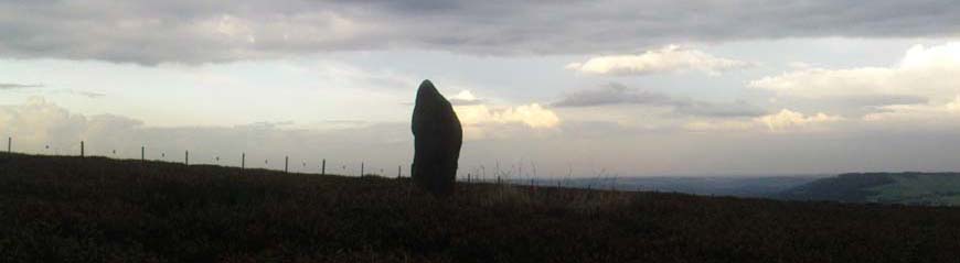
The Bull Stone - towards Otley. Single standing stone 1.8m high having a square cross-section at its base, tapering upwards to a point. This millstone grit stone has not been shaped. It may have come from an outcrop somewhere to the north.
Please note I did the above map many, many years ago and don't know whether it is still accurate ?


