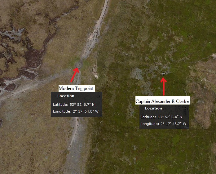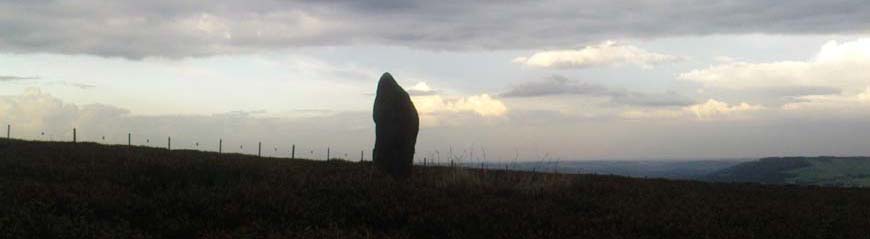


In 1841, when making the principal triangulations for the Ordnance Survey, Captain Alexander R Clarke included the following in his descriptive text on the summit of Pendle Hill: “There is a round conical barrow about 10 feet diameter upon the hill. The centre of the barrow is the station, and is marked by a stone measuring 30 inches by 18, with a hole jumped in it.
Altitude above mean sea level: - 1816.4 feet.”
The point described by Clarke is what we now know as the white-washed triangulation pillar which stands on a raised cobbled circular mound upon the summit point known historically as The Beacon or Big End. Beacons sited upon prominent hills were first established in Lancashire by the Earl of Chester to warn of Scottish raids into the county, Pendle being one of them. By such a method a warning could be sent over a distance of 60 miles in 11 minutes. The beacons consisted of a raised platform of iron supported by stout oak posts, barrels of tar being used as fuel. These were recorded in use up to Napoleonic times and into the present to celebrate National events. What Clarke describes as a “round conical Barrow about 10 feet diameter” may well be the old signal beacon foundation, the “stone measuring 30 inches by 18, with a hole jumped in it” may be that that held the oak beam support.
As to whether the “round conical barrow” referred to by Clark was ever a Bronze Age burial mound must remain one of conjecture.
(info' on Captain Clarke from Danny)