

REVIDGE HILL BURIAL MOUND, BLACKBURN SD 674 293
Revidge Road was constructed in 1826 under the direction of the road maker John McAdam. It was one of a number of relief measures to alleviate the distress and find work for the starving weavers. Just off Revidge Road, on the left going to Billinge End was the Mile End handloom weaving colony (now Mile End Road) where as late as 1851 three-quarters of those in employment were still engaged in handloom weaving. The bricked-up cellar loomshop windows can still be seen to-day. The cottages are constructed of large blocks of rich red sandstone that outcrops here on Revidge. Revidge Road stands on the line of the ancient trans-Pennine trade route, being a part of the Pendle Massif Ridgeway.
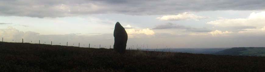
A water storage tank once stood at Hardmans Gap at 755ft above sea level on the summit of Revidge. The ‘Tank’ or ‘Blackburn Pier’, as it was fondly known, was constructed by Aston Frost & Co. Ltd., Engineers of Blackburn, in 1897 to supply water to the Revidge area. The Tank offered great views over this part of Lancashire and the lands beyond for those who made the walk up to the heights of Revidge and climbed the iron steps; Blackpool Tower, Morecambe Bay, the southern Lakeland Fells, the Bowland Fells, Whernside, Ingleborough, Pen-y-Ghent, the Craven Fells and the Lancashire/Yorkshire Pennines came into view, and before the trees obliterated the view Hameldon, Wetstone Edge, Darwen Tower, Winter Hill and even Snowden 80 miles away could all be seen on a clear day. A mounted indicator disc gave direction and distance to all these visible points.
This important and well loved piece of Blackburn’s Heritage was sadly demolished in 2001 as Blackburn Borough Council officers and North West Water officials would not allot funds for its preservation, as preservation of their own extraordinary high salaries, expenses and bonuses must take precedence over the Public Good. No archaeological investigation of the site was undertaken during or after the demolition of the site – may they sky fall in on them!
‘He who is not a man of taste and skilled in learning
Has no right to tread the soil of Lancashire.
He who is not a man of invention and judgment had much better die.
Why should such persons clutter up this sacred earth by merely living?’
(The Lancashire Dance)
On July 26th, 1879, whilst workmen were employed in clearing the rock on the upper edge of the old stone quarry known as Revidge Delf at a point where the Tank once stood, there was uncovered the remains of a burial from the Bronze Age Period.
The sepulchral urn, which was the only object of antiquity found, stood in an inverted position, signifying a female burial, was embedded in a layer of indurated sand upon gritstone about 4ft. below the surface of the ground. On being turned over, the urn was seen to be completely filled with fragments of human bones, evidently the remains of a body consumed by fire, as the bones were very dry, porous and calcined. Portions of the skull, jaw, vertebra, and the bones of the arms, hands, legs and feet, and a number of teeth were distinguishable amongst the mass. The urn is of Middle Bronze Age type with an overhanging rim. The ornamentation is composed of zigzag lines on the central part of the urn, and a herringbone pattern on the deep rim, the lower part of the surface being plane.
It is now held that a major Bronze/Iron Age settlement was sited around the Blackburn area. Revidge is on the Billinge/Billington hill network, names of a common origin going back to the pre-Roman Brigantian era. In recent years a number of Bronze Age artefacts have been found on this hill range along with three other burial sites.
The place-name ‘Revidge’ means the ‘Reeve’s edge/ridge’, a reeve being a chief estate manager/steward in Anglo-Saxon times. During the construction of the tennis courts at the top of the Park Roman coins, tiles, and pottery was found among the buried foundations of some ancient buildings. Nearby the Roman road between Manchester and Ribchester crosses Revidge, part of the ancient trans-Pennine trade route, at Four Lane Ends, and it is not unlikely that a Roman estate stood above Pemberton Clough on Revidge.
Given that Whalley was the caput/capital of the pre-Conquest Blackburnshire, and that the shire was divided into two commotes, represented at the time of the Conquest by the parishes of Whalley and Blackburn, it is fair to suppose that a major estate centre was established at Blackburn. A clue may be in the place-name ‘Pemberton Clough’:
The town of Blackburn grew up around an ancient salter’s ford that a Roman road once crossed and takes its name from that crossing; a brook, the Blackwater, a tributary of the Darwen. Blackburn is not a settlement name. Pemberton however is a far better contender for the name of a significant settlement/estate. Pemberton is a compound of a topographical feature and a land organisation complex/structure. The name means ‘demesne below the hill mound’ - an estate attached to a manor retained by the lord for his sole use standing below a hill with a burial mound on its summit. Pemberton, if an older 7th century name for Blackburn, may shed some light on the territorial organisation of the lands between the Ribble and the Mersey in the Anglo-Saxon period that may have its roots in the post-Roman period when the kingdom of Rheged became dominant.
The urns, along with other finds from the area, are held by Blackburn Museum Services.
Revidge Road was constructed in 1826 under the direction of the road maker John McAdam. It was one of a number of relief measures to alleviate the distress and find work for the starving weavers. Just off Revidge Road, on the left going to Billinge End was the Mile End handloom weaving colony (now Mile End Road) where as late as 1851 three-quarters of those in employment were still engaged in handloom weaving. The bricked-up cellar loomshop windows can still be seen to-day. The cottages are constructed of large blocks of rich red sandstone that outcrops here on Revidge. Revidge Road stands on the line of the ancient trans-Pennine trade route, being a part of the Pendle Massif Ridgeway.
A water storage tank once stood at Hardmans Gap at 755ft above sea level on the summit of Revidge. The ‘Tank’ or ‘Blackburn Pier’, as it was fondly known, was constructed by Aston Frost & Co. Ltd., Engineers of Blackburn, in 1897 to supply water to the Revidge area. The Tank offered great views over this part of Lancashire and the lands beyond for those who made the walk up to the heights of Revidge and climbed the iron steps; Blackpool Tower, Morecambe Bay, the southern Lakeland Fells, the Bowland Fells, Whernside, Ingleborough, Pen-y-Ghent, the Craven Fells and the Lancashire/Yorkshire Pennines came into view, and before the trees obliterated the view Hameldon, Wetstone Edge, Darwen Tower, Winter Hill and even Snowden 80 miles away could all be seen on a clear day. A mounted indicator disc gave direction and distance to all these visible points.
This important and well loved piece of Blackburn’s Heritage was sadly demolished in 2001 as Blackburn Borough Council officers and North West Water officials would not allot funds for its preservation, as preservation of their own extraordinary high salaries, expenses and bonuses must take precedence over the Public Good. No archaeological investigation of the site was undertaken during or after the demolition of the site – may they sky fall in on them!
‘He who is not a man of taste and skilled in learning
Has no right to tread the soil of Lancashire.
He who is not a man of invention and judgment had much better die.
Why should such persons clutter up this sacred earth by merely living?’
(The Lancashire Dance)
On July 26th, 1879, whilst workmen were employed in clearing the rock on the upper edge of the old stone quarry known as Revidge Delf at a point where the Tank once stood, there was uncovered the remains of a burial from the Bronze Age Period.
The sepulchral urn, which was the only object of antiquity found, stood in an inverted position, signifying a female burial, was embedded in a layer of indurated sand upon gritstone about 4ft. below the surface of the ground. On being turned over, the urn was seen to be completely filled with fragments of human bones, evidently the remains of a body consumed by fire, as the bones were very dry, porous and calcined. Portions of the skull, jaw, vertebra, and the bones of the arms, hands, legs and feet, and a number of teeth were distinguishable amongst the mass. The urn is of Middle Bronze Age type with an overhanging rim. The ornamentation is composed of zigzag lines on the central part of the urn, and a herringbone pattern on the deep rim, the lower part of the surface being plane.
It is now held that a major Bronze/Iron Age settlement was sited around the Blackburn area. Revidge is on the Billinge/Billington hill network, names of a common origin going back to the pre-Roman Brigantian era. In recent years a number of Bronze Age artefacts have been found on this hill range along with three other burial sites.
The place-name ‘Revidge’ means the ‘Reeve’s edge/ridge’, a reeve being a chief estate manager/steward in Anglo-Saxon times. During the construction of the tennis courts at the top of the Park Roman coins, tiles, and pottery was found among the buried foundations of some ancient buildings. Nearby the Roman road between Manchester and Ribchester crosses Revidge, part of the ancient trans-Pennine trade route, at Four Lane Ends, and it is not unlikely that a Roman estate stood above Pemberton Clough on Revidge.
Given that Whalley was the caput/capital of the pre-Conquest Blackburnshire, and that the shire was divided into two commotes, represented at the time of the Conquest by the parishes of Whalley and Blackburn, it is fair to suppose that a major estate centre was established at Blackburn. A clue may be in the place-name ‘Pemberton Clough’:
The town of Blackburn grew up around an ancient salter’s ford that a Roman road once crossed and takes its name from that crossing; a brook, the Blackwater, a tributary of the Darwen. Blackburn is not a settlement name. Pemberton however is a far better contender for the name of a significant settlement/estate. Pemberton is a compound of a topographical feature and a land organisation complex/structure. The name means ‘demesne below the hill mound’ - an estate attached to a manor retained by the lord for his sole use standing below a hill with a burial mound on its summit. Pemberton, if an older 7th century name for Blackburn, may shed some light on the territorial organisation of the lands between the Ribble and the Mersey in the Anglo-Saxon period that may have its roots in the post-Roman period when the kingdom of Rheged became dominant.
The urns, along with other finds from the area, are held by Blackburn Museum Services.
